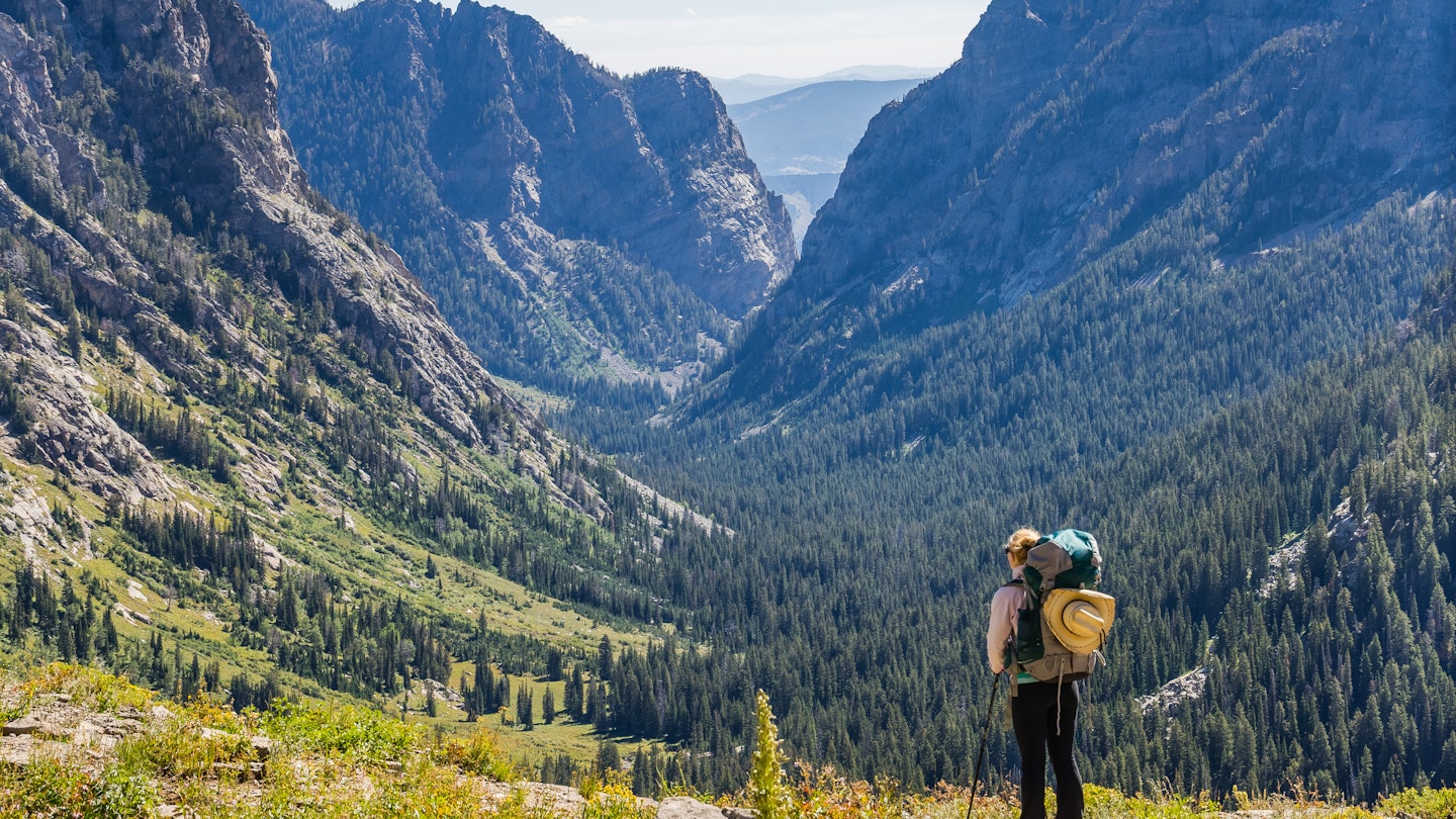
Finding a fabulous hiking trail in Jackson Hole is easy. However, picking which one to follow can be quite challenging.
Early fur trappers used the term “hole” to describe a valley entirely enclosed by mountains. This term precisely describes Jackson Hole, with its expansive alpine meadows and sagebrush highlands, flanked by the stunning Teton Range to the west and the Gros Ventre Range to the east. Moreover, peaks extend in various directions, including the Hobart Range just outside the town of Jackson; the Snake River range; and the Wind River Range, where Gannett Peak, soaring at 13,804 feet, claims the title of the tallest mountain in the state.
The result is that hikers face a delightful dilemma: how to choose from hundreds of trails, each offering unique temptations—a cascading mountain stream, a serene alpine lake, or the triumph of summit views stretching 360 degrees.
Below is an attempt to help you make a judicious choice. Our selection of the area’s best hikes features both popular favorites and lesser-known gems.

Cirque Trail, Jackson Hole Resort Aerial Tram
2.5 miles; easy to moderate
This mostly downhill adventure begins with a thrilling aerial tram ride up 10,450ft Rendezvous Mountain in the Jackson Hole Mountain Resort ski area, reaching the summit in just 12 minutes. Climb the stairs to Corbett’s Cabin, where you can grab snacks or enjoy a plate of waffles before hitting the trail.
Look for signs for the Cirque Trail, a challenging single track that switchbacks over 1300 feet down to the Bridger Gondola. More difficult than it initially appears, it involves several steep descents over loose rock, yet rewards hikers with stunning views as it meanders through meadows alive with wildflowers.
Alternatively, you can choose the wider gravel road that zigzags down the mountain to the west, shortening the hike to 1.8 miles but requiring a short ascent to the gondola at the end. A satisfying reward, regardless of the route, is a cold drink and savory snacks at the top-of-gondola restaurants. Families with small children and those seeking a gentler experience can enjoy the half-mile Top of the World stroll or the moderate two-mile trek to Rock Springs Overlook. It’s important to note that any of these trails can be tackled in reverse, riding the gondola up and then hiking to the summit.
Snow King
2 miles; moderate
Located less than a mile from downtown Jackson at the base of the Snow King ski resort, this manageable trail to the summit is a local’s favorite for lunchtime and after-work hikes. Although fit hikers can reach the top within an hour, the hike involves 1500 feet of elevation gain up a steep trail (there’s a lift available for an easier downhill return)—the breathtaking views are certainly worth the effort. The panorama opens to the Teton and Gros Ventre ranges, along with the valley below; you may catch a glimpse of Yellowstone’s mountains hazy on the horizon. Several additional trail options from the Snow King trailhead offer connections to the Cache Creek trail network, enabling hikers to create custom longer routes.
Sleeping Indian
12 miles roundtrip; experienced hikers only
Sleeping Indian, rising to 11,239 feet, is one of the highest peaks in the Gros Ventre wilderness. It presents an ideal challenge for seasoned hikers: a 12 to 14-mile round trip (depending on your chosen route) through whitebark pine forests and expansive meadows. Many consider it to offer some of the finest views of the Tetons from its peak. Often referred to as Sheep Mountain (a name that appears on some maps), this peak derives its name from the silhouette visible in the rocky ridge that ascends beyond the tree line. The ascent includes over 4000 feet of elevation gain starting from 7000 feet, with a few rocky scrambles at the summit—not recommended for first-time altitude climbers or anyone new to peak climbing. The abundance of lupine, paintbrush, and black-eyed Susan flowers adorning the meadows along this trail makes it especially popular among wildflower photographers.

Phelps Lake Loop
6.3 miles; easy to moderate
Located at the north end of Jackson Hole, Grand Teton National Park is adored by hikers for its wealth of lesser-known trails, which allow visitors to enjoy its babbling streams and secluded lakes in peaceful solitude. The 1106-acre Laurance S Rockefeller Preserve—a favorite among families for its gentle terrain and frequent wildlife sightings—provides access to the Phelps Lake Loop.
This trail features various options, including the Woodland Trail leading directly around the lake, or the less direct Aspen Ridge trail, which is particularly enchanting during the fall when the aspen groves glow in warm hues. Before commencing your hike, take a few moments to learn about the native flora and fauna at the well-designed Laurance S Rockefeller Preserve Center. Please note that a section of this trail is currently closed due to reconstruction of the Phelps Lake Outlet Bridge; check the preserve’s website for the latest trail conditions. Additionally, it is crucial to remember that dogs are not permitted in the preserve, even on leashes.
Alaska Basin
16-mile loop; challenging
Similar to Grand Teton National Park, Alaska Basin in the Jedediah Smith Wilderness boasts breathtaking views of towering peaks, challenging trails for long-distance hiking, and lush meadows that are abundant with wildlife viewing opportunities, including moose and bears. Moreover, the area tends to be far less crowded and requires no entrance fee. Accessed from either the west or east side of the Teton Range, Alaska Basin is a pristine, bowl-shaped valley interwoven with rivers and streams, presenting stunning vistas at every turn.
With an expansive trail network that can keep you engaged for days, this basin is a backpackers’ favorite and requires no permit for camping since it lies outside the national park boundaries. You can access Alaska Basin from either the eastern or western side of the Tetons, requiring an approximate eight-mile trek from either direction to reach the basin itself. Consequently, plan for a full day’s hike to complete the entire loop. Note that river crossings may be necessary during this hike, typically via logs or stepping stones. As always with backcountry excursions in the Tetons, carrying bear spray is highly advisable.
Grand Targhee Chairlift Hikes
.5 mile–5 miles; varied
On the west side of Jackson Hole, the chairlift at Grand Targhee ski resort opens up an extensive network of trails, all offering marvelous views over the Jedediah Smith Wilderness and the Tetons from new perspectives. At the summit, the half-mile Summit Trail and the three-quarter-mile Marmot Trail cross the rocky ridge top, with stops at the Summit Observation Platform and Summit Nature Center for views and exhibits. The aspens alongside Bannock Trail are particularly gorgeous, leading through diverse pine and hardwood forests before arriving at the Summit Observation Platform. The descent is just as enjoyable as the ascent, as the valley unfolds beneath your feet, growing closer with each step.
Table Mountain
11 miles; challenging
The climb to Table Mountain is a rite of passage for those eager to experience diverse terrains and achieve a wilderness summit within a manageable day hike. Most hikers choose to approach this loop by traversing the steep 4.5-mile Face Trail in one direction and the 6.5-mile North Teton Trail in the other (your preference between a more gradual ascent versus a steeper climb will likely influence your choice). If you plan to take a refreshing swim post-hike, returning via the North Teton Trail—which follows the North Fork of Teton Creek through a verdant canyon—can be particularly rewarding. Observe that these lush meadows and woodlands are prime habitat for moose and bears, so remain watchful for mothers with their young ones. Those pressed for time can also complete an out-and-back trip solely on the Face Trail, reducing the distance to 9 miles. Be prepared to enjoy wild huckleberries along the way!
Darby Canyon and Wind Cave
6.3 miles; moderate
Who doesn’t love the eerie charm of a cave or the allure of a dramatic waterfall? This combination makes the hike up Darby Canyon to Wind Cave incredibly popular. Initially, the trail tempts you with a meandering path through dense forests and a gentle stream crossing. However, as you ascend, it enters the Jedediah Smith Wilderness and ventures into a narrowing canyon flanked by rugged cliffs.
Ledges, overhangs, and cascading streams provide welcome resting spots—much needed, given the 1800-foot elevation gain. Soon, the cave becomes visible along with the waterfall that appears to spring forth from its depths. The trail leads to the base of the falls, and if you are cautious with your footing, you can clamber up to the cave. The narrow, high-ceilinged cave invites exploration; venture inside, and you’ll encounter the frigid breeze that gives it its name. An underground passageway connects Wind Cave with the nearby Ice Cave, but only experienced cavers should venture past the entrance, as sudden drop-offs into deep water can occur.


